Wondering if your boat will actually fit the bridges and channels around your future Islamorada home? You are not alone. In 33036, water access is the lifestyle, and a few inches of clearance or draft can make the difference between effortless days on the water and constant detours. In this guide, you will learn what bridge clearance and boat draft really mean for your route options, how to measure correctly, which official sources to trust, and how to match your vessel with the right property. Let’s dive in.
Why bridge clearance matters in 33036
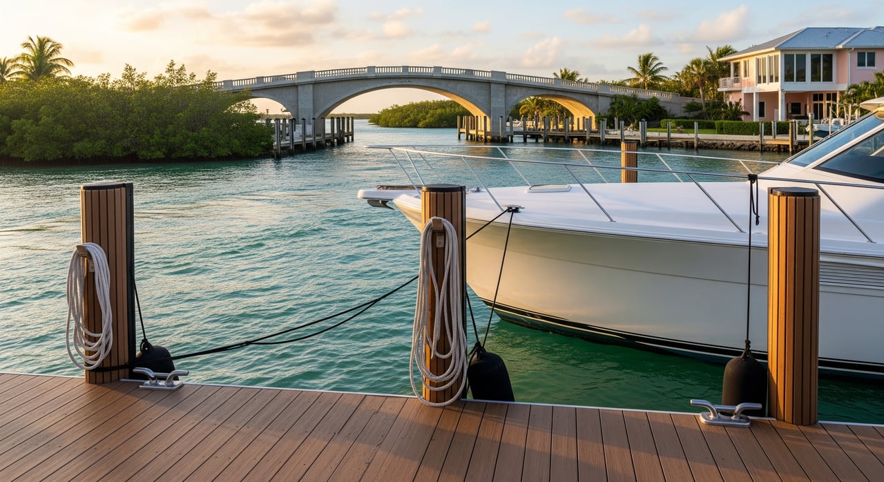
Islamorada’s Upper Matecumbe Key is a boater’s dream because you can choose the ocean side or the backcountry inside. That choice often comes down to bridges and depth. Your actual route from a private dock or marina may include low fixed bridges on canal systems or inside channels, even if the open Atlantic is only minutes away by water.
If you want quick access to flats or backcountry, draft matters as much as clearance. If you live for reef and offshore runs, air draft may only be an issue from your dock to the ocean cut. Planning ahead keeps your options open and protects your investment.
Key terms you will use
Air draft
Your boat’s air draft is the vertical distance from the waterline to the highest fixed point, such as a radar arch or mast. This determines whether you can pass under a fixed bridge. If you can lower antennas or arches, record a raised and a lowered measurement.
Draft
Your draft is how deep your boat sits below the waterline. Draft drives your safe route through shallow channels and flats, especially inside on Florida Bay. Load, fuel, and passengers change draft, so measure as you run in real life.
Vertical clearance and datum
A bridge’s vertical clearance is the distance from the water surface to the underside of the bridge. The published clearance is tied to a datum, such as Mean High Water or Mean Lower Low Water. Always confirm the datum used before you compare it to your air draft.
Fixed bridges vs drawbridges
A fixed bridge has a set clearance. If your air draft exceeds it, you do not fit. A drawbridge can open for more height, but openings follow specific rules and hours. Operations and notices are published by authorities and can change.
Where to get official numbers
Use authoritative sources first, then confirm with local knowledge before a first run.
- Check bridge clearances, channel depths, and aids to navigation on the latest NOAA charts with the NOAA Chart Viewer. Note the clearance and the datum listed on the chart.
- Confirm tides and compute real-time clearance using NOAA Tides & Currents. Pick the nearest station to your route.
- Review the US Coast Guard Local Notice to Mariners for District 7 for temporary reductions in clearance, bridge maintenance, or changed aids to navigation.
- For local updates about bridge operations or maintenance, check the Village of Islamorada public notices or public works pages.
- For speed zones and safety rules that affect timing through canals and bays, see Monroe County’s Boating and Waterways resources.
- For structural and inventory details on state highway bridges, use the FDOT Bridge Maintenance Office and related bridge data.
Community tools like ActiveCaptain and popular chart apps are great for recent user reports. Treat those as supplemental and verify against NOAA charts and USCG notices before you rely on them.
Measure your boat the right way
Accurate measurements reduce surprises and widen your property options.
- Measure air draft from the waterline to your highest fixed point with the boat loaded as you run. Include any equipment that will stay up underway, like fixed lights. If you can lower elements, record both raised and lowered dimensions.
- Confirm draft at normal operating load. If you have tabs, lifting strakes, or other features that change running attitude, note those settings for shallow passages.
- Keep measurements in your phone and share them with your agent so every address you tour is pre-screened for your routes.
Tide math you will actually use
Bridge clearance is published against a specific datum. Your job is to translate that number into what you have right now.
- Find the published bridge clearance and note the datum.
- Check the predicted tide height at transit time from NOAA Tides & Currents for the closest station.
- Compute effective clearance:
- Effective clearance equals Published clearance (same datum) minus the difference between the current tide and the datum.
Example workflow: If a bridge lists clearance at Mean High Water and the tide is higher than MHW at your transit time, you have less clearance than published. If the tide is lower than MHW, you have more. Give yourself a buffer for chop and vessel motion.
Routes from Upper Matecumbe: what to check
Inside and backcountry runs
The Florida Bay side is popular for flats fishing and quiet exploring. Shallow-draft skiffs, bay boats, and small center consoles often shine here. Check charted depths against your draft, use the marked channels, and plan around tide. Seagrass and shoaling shift, so confirm with a recent chart and local marina guidance before a first-time run.
Ocean and Hawk’s Channel runs
For reef dives, wrecks, and offshore fishing, many owners run the ocean side, where bridges are often less of an issue once you are outside. Your focus is the path from dock to the ocean cut. Chart your route to confirm you do not have to squeeze under a low fixed span on the way out, and use the latest USCG notices to catch any changes to aids or markers along the cut.
Northbound toward Key Largo
If you head north inside on the Intracoastal or inside channels, list any fixed bridges and verify their published clearances and the datum. On the ocean side, identify your inlet or cut and cross-check for any short fixed spans on your approach from the property.
Southbound toward Long Key and Marathon
The same logic applies south: pick inside or ocean side and list each potential constraint. Inside runs may involve longer stretches of slow speed in manatee zones, which affects timing and sea state planning. Use the Monroe County resources for speed zones and plan your windows accordingly.
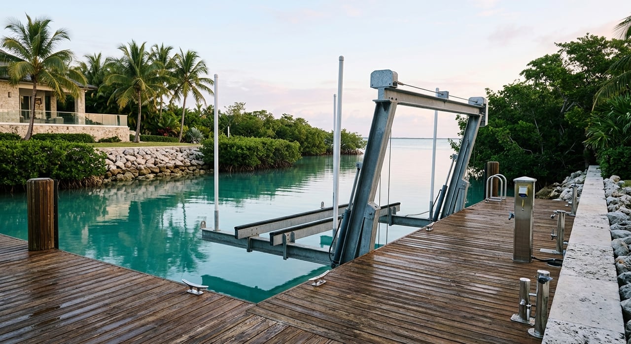
From your private dock vs a marina
Some homes sit on deep, straight canals with quick access to marked channels. Others may require running skinny water before you reach a marked line. Ask for any available dock surveys or soundings at mean low water. If none exist, plan a professional sounding or a test run with a local captain before you close.
Buyer checklist: match boat to address
Use this step-by-step plan to protect your boating lifestyle and your investment.
- Define your goals. Backcountry and flats, reef and offshore, cruising, or a mix. Decide what matters most.
- Measure your vessel. Record air draft in raised and lowered setups and draft at typical load.
- Map the property route. From dock to open water, use NOAA charts to mark the exact path and the bridges you must pass.
- Verify each bridge. Pull the published clearance, note the datum, and check the USCG Local Notice to Mariners for temporary restrictions. If it is a drawbridge, confirm opening procedures and any required notice.
- Plan around tides. Use NOAA Tides & Currents for predictions at your transit time and compute effective clearance. Add a conservative buffer.
- Check depths and under-keel margin. Compare charted depths to your draft at the chart datum. Aim for at least 1 to 2 feet of water under your keel, more over seagrass beds.
- Do a test run. Choose a calm day, matching your typical load. If margins are tight, hire a local captain to pilot and advise.
- Keep documentation. Save dock surveys, soundings, and notes on prior transits. Share these with your insurance provider if needed.
Local rules and safety notes
Bridge operations and marine notices are authoritative, so always check the latest USCG Local Notice to Mariners before a critical passage. Tides and weather shape run windows in the Keys. During strong northerlies or after storms, expect different sea states inside and outside.
Many canals and backcountry zones are posted with slow-speed or no-wake rules to protect manatees and seagrass. Review Monroe County’s Boating and Waterways guidance and factor those speeds into your timing. Confirm fuel, pump-out, and marina availability for your preferred routes, especially during peak season and tournaments.
A local partner who speaks boat
The right Islamorada home is the one that fits your life on the water. When you work with a team that understands air draft, draft, and route planning, you can focus on the fun parts while we help you avoid surprises. From pre-screening addresses for your specific vessel to coordinating a test run and gathering dock documents, we bring maritime know-how to your purchase plan.
Ready to align your boat and your Keys home? Connect with The Florida Keys Sold Sisters for concierge-level guidance and local expertise.
FAQs
What is air draft and why does it matter for Islamorada buyers?
- Air draft is the height of your boat from the waterline to the highest fixed point, and it determines whether you can pass under fixed bridges on the way from your dock to the ocean or backcountry.
How do tides change bridge clearance in 33036?
- Published bridge clearance is tied to a datum such as Mean High Water, so your real-time clearance equals the published number adjusted by the current tide height from NOAA Tides & Currents.
Which official sources should I use for bridge and channel data near Islamorada?
- Use the NOAA Chart Viewer for charts, the US Coast Guard Local Notice to Mariners for changes or restrictions, and local updates from the Village of Islamorada.
Can I reach the ocean without dealing with low bridges?
- Many Islamorada routes reach the ocean with minimal bridge constraints, but the exact path from your dock can include fixed spans, so always chart the route and verify clearances before you assume a clear shot.
How much water under my keel should I plan for on backcountry runs?
- A conservative rule of thumb is 1 to 2 feet of water under your keel, with extra margin over seagrass flats and in areas known for shoaling.
What if I do not own the boat yet but plan to buy one after the home?
- Define your likely boat type and size, then use the checklist to test routes with those dimensions so you buy a home that supports your future vessel without compromises.