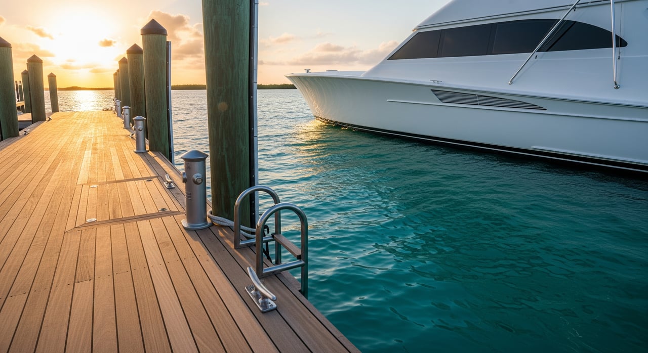
Shopping for a waterfront home in Islamorada and seeing “deep water dockage” everywhere? The phrase sounds simple, but in the Keys it hides a lot of nuance. Your boat, the approach channel, tides, and permits all matter. In this guide, you’ll learn what the term really means in Islamorada, how to match a property to your vessel, and the exact steps to verify a listing’s claims before you buy. Let’s dive in.
What “deep water dockage” really means
There is no universal number that defines deep water. What matters is whether the route from open water to the dock has enough controlling depth for your specific boat at the relevant tide. In Islamorada, charts are typically referenced to Mean Lower Low Water, so a quoted depth only helps if you know the datum and the approach’s shallowest point. The safe answer is always vessel-specific and based on current data.
Key terms you must know
Chart depth vs. controlling depth
Chart depths on NOAA charts are tied to a tidal datum, commonly Mean Lower Low Water (MLLW). That means a “6 ft” charted area is 6 ft at MLLW, not necessarily when you arrive. Controlling depth is the shallowest point along the approach or basin that limits passage. For navigation and buying decisions, controlling depth is the number that matters.
Tide datums and why they matter
Even in the Keys, where tidal ranges are modest, a change of 1 to 2 feet can determine whether you clear a flat or bump bottom. Datums you’ll see include MLLW, Mean High Water (MHW), and Mean Sea Level (MSL). Always confirm which datum a quoted depth uses.
Draft and air draft
Your boat’s draft is the distance from the waterline to the lowest point of the hull or running gear. You also need margin above that for safety. Air draft is the height above the waterline and matters if there are fixed bridges or overhead lines on your route. Both can be limiting in the Keys depending on the canal and access.
Slip length, beam, and turning
A slip must fit your boat’s length and beam, and you need space to turn in the basin or canal. The turning radius depends on your vessel length and propulsion, along with wind and current. Expect to need several times your boat’s length for comfortable turning, and verify the actual maneuvering room on site.
“No fixed bridges” and “ocean access”
Listings may promise “ocean access” or “no bridges,” but routes can still include narrow, shallow passes or marked channels with shifting bottoms. Always verify the actual path from the dock to open water and identify the controlling depth along the way.
Islamorada waterway realities
Islamorada spans oceanfront flats, patch reefs, and bayside channels. You’ll find shallow flats, seagrass beds, and coral heads that create localized shoaling. Some channels are maintained and periodically dredged, while others are not. After major storms, sand can shift and channels can change, so recent soundings matter. The area also falls within the Florida Keys National Marine Sanctuary, which shapes what you can and cannot do to the seabed around a dock.
How deep is “deep” for your boat?
There is no one-size depth. Use these general guidelines as a starting point and confirm for your vessel at MLLW:
- Small center console or skiff up to about 25 to 30 feet: draft around 1 to 2 feet. Many can transit in 3 to 4 feet with a safety margin.
- Bay or express boats around 30 to 40 feet: draft about 2 to 3 feet. Target 4 to 5 feet for comfort.
- Cruisers and small yachts around 40 to 60 feet: draft around 3 to 4 feet. Plan for 5 to 6 feet or more.
- Sportfishers and larger yachts: drafts vary widely from about 3 to 8 feet or more. Many need 6 to 10 feet at MLLW.
- Large motor yachts or deep keel sailboats: may require 8 to 12 feet or more and ample turning room, plus appropriate berth length and beam.
Experienced mariners usually want 1 to 2 feet of safety margin above the vessel’s draft to account for wave action, squat, and bottom variability. Adjust your margin based on your boat, the approach, and typical conditions.
How to verify a listing’s dockage
Documents to request
- As-built dock drawings with pier length, pile layout, and labeled depths with a stated datum.
- A recent hydrographic or sonar sounding of the approach and slip, with survey date and datum.
- Copies of permits and approvals, including any sovereign submerged lands authorization, local dock permits, relevant environmental resource permits, and U.S. Army Corps authorization if dredging was done.
- Dredging history, last-dredged date, and any maintenance agreements.
- Recorded easements or community agreements that affect access or responsibilities.
Field checks that protect you
- Review the closest NOAA nautical chart and nearest tide station to confirm the datum and typical tidal range. Compare to your boat’s draft plus margin.
- Commission a hydrographic sounding at or near low tide, preferably at MLLW, over the approach and berth.
- Ask a local licensed captain familiar with Islamorada channels to run the route at low tide to confirm passability and turning space.
- Inspect the approach for obstructions such as debris, unmarked reef, or unauthorized moorings, and confirm the condition of channel markers.
- Identify any fixed bridges or overhead lines and confirm actual air draft limits.
Pros to bring onto your team
- A licensed marine surveyor for hydrographic measurements and dock condition assessment.
- A local captain or surveyor who knows Upper Keys channels and typical shoaling patterns.
- A marine contractor for practical input on dredging feasibility and permitting pathways.
Smart questions to ask
- What is the controlling depth at the dock and in the nearest channel, and what tidal datum are those depths referenced to?
- When was the approach last surveyed or dredged, and who maintains it?
- Are there any fixed bridges or overhead obstructions, and what is the air draft limit?
- Is there a recorded agreement for dredging or channel upkeep, and who pays?
- Are there association rules on vessel size, beam, horsepower, or liveaboard use?
- Are fuel, shore power, and pump-out services available or nearby as needed?
Red flags to watch for
- Depths quoted without a datum or without a survey date.
- “Deep water” claims that are years old in areas known for shoaling and no maintenance history.
- No documented maintenance responsibility in a community canal that shows recurring shoaling.
- Proximity to protected seagrass or reef zones where dredging or dock expansion would likely be restricted.
Permits, rules, and environmental context
Owning a Keys waterfront home means respecting a layered permitting environment that protects sensitive habitats.
- Florida Department of Environmental Protection may require sovereign submerged lands authorization or environmental resource permits for docks over state-owned bottoms.
- U.S. Army Corps of Engineers permits are typically required for dredging, fill, or major work in navigable waters.
- Florida Keys National Marine Sanctuary rules can limit activities that affect coral, seagrass, and benthic habitats and often require special review.
- Monroe County permits and code compliance apply to docks, seawalls, and waterfront structures.
- Local zoning and association rules can affect dock dimensions, vessel types, and maintenance obligations.
Plan for time and cost if you need to modify existing structures or address shoaling. Insurance carriers or lenders may also ask for documented safe access, including surveys, for certain coverages or collateral arrangements.
A simple buyer workflow that works
If you are evaluating a property from out of market, follow this streamlined process:
- Request as-built dock drawings, a recent hydrographic survey with datum, and all permit and dredging documents.
- Review NOAA charts and the nearest tide station to understand assumed depths and tidal swing.
- Hire a local captain or marine surveyor to run the approach at low tide and confirm controlling depths and turning room.
- Confirm who maintains the approach channel and the last-dredged date. Identify recorded agreements that assign responsibility and cost.
- Match berth length, beam, pilings, and utilities to your vessel, and verify maneuvering space relative to your boat’s length and propulsion.
Islamorada realities for different access routes
In Islamorada, a home’s dock can lead to very different boating experiences depending on the route. Bayside canals may connect to channels that shoal after storms. Ocean-side access can include flats and patch reefs that require careful transit on marked routes. Even where “no fixed bridges” applies, a shallow or narrow pass can still be the limiting factor. Recent, datum-referenced data and a low-tide trial run are the best way to ensure your boat can come and go comfortably.
Bottom line: define “deep” for your boat
Treat “deep water dockage” as an invitation to verify specifics. Anchor your decision to controlling depth at MLLW, confirm turning room and air draft, and review permits and maintenance agreements. With the right documents and the right local pros, you can buy with confidence and enjoy the Islamorada lifestyle you came for.
Ready to evaluate a specific property or canal? Our team pairs boutique service with real, on-the-water expertise to help you confirm the fit before you close. Start a conversation with The Florida Keys Sold Sisters and get a clear plan for your boat and your home search.
FAQs
What is controlling depth in Islamorada?
- It is the shallowest point along the approach or basin that limits passage; rely on controlling depth referenced to MLLW for vessel-specific decisions.
How do I know if my 40-foot boat fits a canal home?
- Compare your draft plus a safety margin to controlling depths at MLLW, confirm turning room several times your LOA, and verify slip length and beam.
Does “ocean access” mean I can always reach the Atlantic?
- No, routes may include shallow or narrow passes; verify the controlling depth and run the approach at low tide with a local captain.
Can I dredge to increase depth at my dock in Monroe County?
- Possibly, but it requires multiple permits and reviews, and activities near seagrass or coral are tightly regulated and may be limited.
Should I rely on NOAA chart depths when buying?
- Use charts for planning, but confirm with a recent hydrographic survey and a low-tide trial run to capture shoaling and post-storm changes.
Who pays for dredging in a community canal?
- Check recorded maintenance agreements; responsibility can rest with an association, a group of owners, or the individual owner depending on the documents.