Ever wondered if you can slip out from Islamorada after breakfast and be snorkeling the reef before your coffee cools? If you keep a boat in Upper Matecumbe (ZIP 33036), you can. Many reefs and sandbars sit close enough for quick, spontaneous runs when the weather lines up. In this guide, you’ll learn realistic travel times from Islamorada, a simple way to estimate your own run, and practical tips that make short reef trips easy and safe. Let’s dive in.
Where the reef sits off Islamorada
The Florida Keys step from nearshore flats to offshore reef in a gentle ladder. Close to Upper Matecumbe you’ll find small patch reefs and rock piles inside the shallower water, then the main Florida Reef Tract farther out. In the Upper Keys, that main reef ridge typically sits about 2 to 6 nautical miles offshore, running parallel to the islands. Some named patches and wrecks extend even farther and require a longer run.
Much of this area falls within the Florida Keys National Marine Sanctuary. That means conservation rules apply, including no anchoring on living coral and using mooring buoys where available. Combine that with Florida state fishing regulations, and you’ll want to plan your stop before you leave the dock.
A quick way to estimate your run time
You can get a reliable estimate with a simple method:
Measure the straight-line distance in nautical miles from your dock or launch to the reef or sandbar. Use a chartplotter, NOAA charts, or a marine app.
Pick your cruising speed in knots. Many small center consoles cruise between 15 and 30 knots in calm water.
Time in minutes (one way) = distance ÷ speed × 60.
Add 10 to 30 percent for wind, current, routing around shoals, a slower approach, and time to pick up a mooring or set up a drift.
Example: Main reef line from Upper Matecumbe
If your target sits 4 nautical miles offshore and you cruise at 20 knots, your base time is 4 ÷ 20 × 60 = 12 minutes. Add a 20 percent cushion for real-world factors and you’re at about 14 to 15 minutes one way. That is a realistic in-season morning run on a calm day with a typical Keys dayboat.
How close are popular spots from 33036?
Below are typical one-way ranges from Matecumbe Beach and nearby docks on Upper Matecumbe. Always verify exact coordinates and hazards on official charts.
Nearshore patch reefs and rock piles
- Distance: about 0.2 to 2.0 nautical miles
- Typical time: 1 to 10 minutes in calm conditions
- Why go: quick snorkeling, light-tackle action, and simple short hops that fit into an hour window
- What to know: water is shallow, so approach slowly and watch for isolated coral heads
Local snorkeling reefs such as Cheeca Rocks
- Distance: typically within about 0.5 to 2.5 nautical miles
- Typical time: 2 to 10 minutes
- Why go: easy, repeatable outings close to shore that are perfect for guests or a late-afternoon swim
- What to know: use mooring buoys where available and follow sanctuary guidance
Main Florida Reef Tract
- Distance: typically about 2 to 6 nautical miles from Islamorada
- Typical time: 5 to 25 minutes, depending on your speed and sea state
- Why go: larger structure for snorkeling and diving, steady reef fishing, and good visibility in calm weather
- What to know: expect more current, more boat traffic on weekends, and a slower approach to find an open mooring
Offshore reefs, wrecks, and distant patches
- Distance: roughly 6 to 12 or more nautical miles
- Typical time: 15 to 60 plus minutes
- Why go: targeted wreck fishing, deeper reef edges, and trolling
- What to know: plan fuel carefully, watch the forecast, and allow extra daylight for a safe return
Sandbars and shallow banks
- Distance: commonly about 0.5 to 3 nautical miles
- Typical time: 2 to 15 minutes
- Why go: easy social stops, a quick swim, and family-friendly lounging
- What to know: depth changes with the tide and channels can be narrow, so follow your charts closely
What changes your timing
A quick math estimate gets you close, but real conditions do the final editing:
- Wind and sea state can force a slower cruise or keep you on the inside.
- Tidal and wind-driven currents can add minutes heading out and shave them on the return.
- Routes around shoals, flats, and channel markers can lengthen the path beyond a straight line.
- Boat type, engine power, load, and passengers all affect comfort and speed.
- Approaches to reefs and sandbars take time. You will slow to pick up a mooring, set a drift, or anchor in sand.
Planning a spontaneous reef run
Build a simple pre-departure routine so you can go from idea to reef without stress.
- Check the marine forecast and radar. Conditions change fast in the Keys, even within a few hours.
- Review tides and currents for channels you plan to use and for your target area.
- Confirm fuel for a round trip plus a 20 to 30 percent reserve, and add extra for idling and setup time.
- Load safety gear: life jackets for all aboard, VHF radio, basic first aid, and a PLB or EPIRB for offshore runs.
- Use official charts for routing, and keep your depth sounder front and center when approaching shallow areas.
- Plan your stop: mooring buoys are common at popular reefs. Anchoring on living coral is prohibited.
- Mind regulations: sanctuary rules and state fishing regulations apply, including protected areas and species rules.
- Time your trip: many locals prefer earlier departures for calmer seas, lighter traffic, and more mooring availability.
Tools locals rely on
- NOAA nautical charts and electronic charts for distances, depths, and hazards
- National Weather Service marine forecasts and buoy observations for wind and seas
- Florida Keys National Marine Sanctuary resources for sanctuary zones and mooring information
- Florida Fish and Wildlife Conservation Commission for up-to-date fishing regulations and licensing
- U.S. Coast Guard Local Notices to Mariners for channel changes and aids to navigation
- Chartplotter and marine apps for quick measuring and safe routing
- Tide and current apps to plan approaches to shallow bars and passes
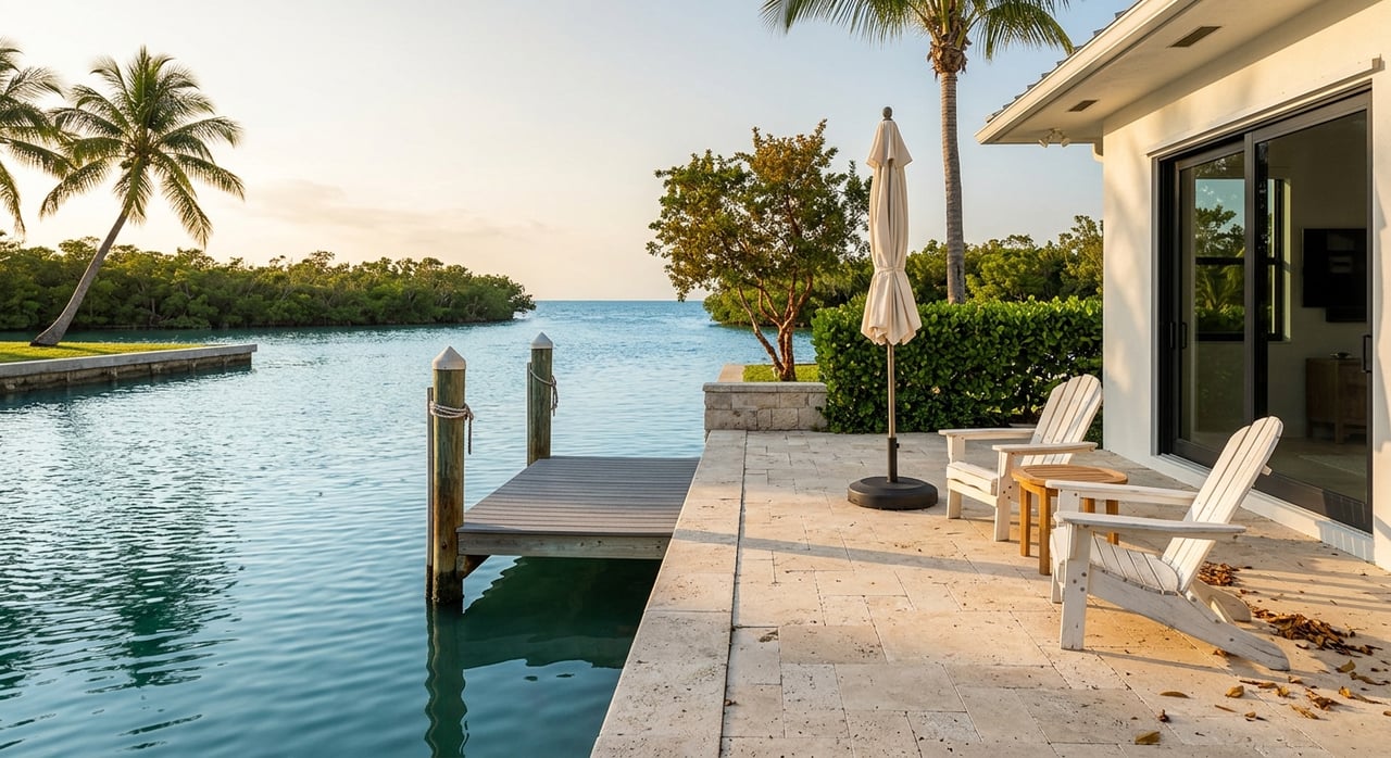
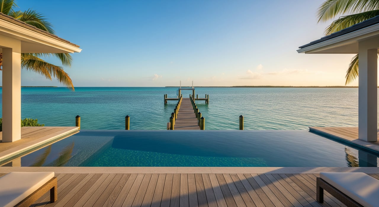
Why this matters when you’re choosing a home
If you dream about quick reef runs, location and dockage details matter as much as square footage. A home with direct ocean access, appropriate water depth at the dock, and a short run to marked channels makes spontaneous trips simple. Bayside properties can still offer excellent access through nearby channels, but exact distances and bridge clearances should be part of your decision.
This is where local maritime expertise pays off. You want clear guidance on dockage depths, channel proximity, typical sea state by exposure, and realistic run times for your specific boat. If you’re comparing properties in 33036 with a focus on boating, we can help you evaluate how each address supports the lifestyle you want.
Ready to balance the reef lifestyle with the right waterfront home? Connect with the team that blends luxury real estate marketing with captain-level knowledge of Keys boating. Reach out to The Florida Keys Sold Sisters to tour properties that deliver the access, dockage, and comfort you need.
FAQs
How far is the main reef line from Islamorada 33036?
- In the Upper Keys, the main Florida Reef Tract typically sits about 2 to 6 nautical miles offshore, which often translates to 5 to 25 minutes one way in calm conditions.
What speed should I use to estimate reef travel time from my dock?
- Many dayboats cruise between 15 and 30 knots in good weather; divide distance by speed and multiply by 60, then add 10 to 30 percent for real-world factors.
Can I anchor on coral at Islamorada reefs?
- No, anchoring on living coral is prohibited within the Florida Keys National Marine Sanctuary; use mooring buoys where provided and anchor only in sand.
Are there reefs within a 10-minute run of Upper Matecumbe?
- Yes, nearshore patch reefs and shallow snorkeling spots such as Cheeca Rocks are often within about 0.5 to 2.5 nautical miles, or roughly 2 to 10 minutes in calm seas.
What home features improve quick access to the reef in Islamorada?
- Key factors include direct ocean access, adequate dockage depth, proximity to marked channels, typical exposure to wind and chop, and any bridge or clearance constraints.